

Churchill River (Hudson Bay)
River in Western Canada
- 3 min read
- 3 chapters

Related on Lably
Through Hydroelectricity and Watt
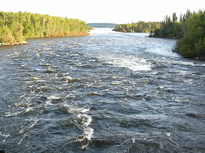
The river is located entirely within the Canadian Shield. The drainage basin includes a number of lakes in Central-East Alberta which flow into a series of lakes in Saskatchewan and Manitoba. The main tributary, Beaver River, joins at Lac Île-à-la-Crosse.
Nistowiak Falls — among the tallest falls in Saskatchewan — are on the Rapid River. Rapid River begins at Lac la Ronge, flows through Iskwatikan Lake, and then into Nistowiak Lake along the Churchill, just north of La Ronge.
A large amount of flow of the Churchill River after the Manitoba — Saskatchewan border comes from the Reindeer River, which flows from Wollaston and Reindeer Lakes. Flow from Reindeer Lake is regulated by the Whitesand Dam. From there, the Churchill River flows east through a series of lakes (Highrock, Granville, Southern Indian and Gauer), then flows via a diversion for hydro-electric generation into the Nelson River (60% of flow), and the rest flows as the Churchill River into Hudson Bay at Churchill, Manitoba (see also Nelson River Hydroelectric Project).
History
The Churchill formed a major part of the "voyageur highway" in the 18th to 20th centuries after Dene people showed Peter Pond the Methye Portage which connects the Hudson Bay watershed with the Clearwater — Athabasca — Mackenzie rivers which flow to the Arctic Ocean. See Canadian Canoe Routes (early).
Sign in to keep reading
2 more chapters are free with a Lably account.
Fish species
The Churchill is also home of several fish species including: walleye, sauger, yellow perch, northern pike, lake trout, lake whitefish, cisco, white sucker, shorthead redhorse, longnose sucker, lake sturgeon, and burbot.
Hydroelectric developments
Island Falls
The only operating hydroelectric generating station on the Churchill River is Island Falls, with a capacity of 111 megawatts (MW). The purpose of the Whitesand Dam mentioned above is to control the amount of water flowing through Island Falls, since the generating station is downstream of the Reindeer River fork.
Wintego Hydroelectric Project
In the 1970s, SaskPower was considering building another hydroelectric station on the Churchill River called Wintego. This station would have been located about 23 kilometres (14 mi) downstream of the Reindeer River forks, and 32 kilometres (20 mi) upstream of Island Falls. The project was expected to cost $338 million (equivalent to $1.3 billion in 2020), including transmission and roads, and the capacity of the station would have been 300 MW.
The cost estimate assumes a 50-year lifespan, but the lifespans of SaskPower's other hydroelectric stations have been proven to be much longer (such as 90 years for Island Falls). Construction of Wintego would also enable the output of Island Falls to increase by 70 MW, and this benefit is not included in the cost estimate above.
Other Saskatchewan
Two other potential hydroelectric developments between the Reindeer River Fork and Island Falls are the Iskwatam Generating Station and the Pita Generating Station, with unknown MW capacities.
Manitoba
In Manitoba, the Bonald and Granville Falls generating stations could produce 110 MW and 120 MW, respectively.