

Tierra del Fuego Province, Argentina
Province in Argentina
- 3 min read
- 8 chapters

Related on Lably
Through Antarctica, Christian mission and Infection
Extent
The effective extent of the province is the eastern part of the island of Tierra del Fuego, Isla de los Estados and adjacent islands.
The province includes Argentina's claims to the Falkland Islands and South Georgia and the South Sandwich Islands (which are British Overseas Territories) and to a segment of Antarctica that overlaps with the British and Chilean claims on that continent. Argentina has no effective control in these territories beyond its own Antarctic bases.
Sign in to keep reading
7 more chapters are free with a Lably account.
History
Tierra del Fuego was first settled by indigenous peoples around 12,000 years ago. When the first Europeans arrived, they encountered a population of about 10,000 indigenous people belonging to four tribes: Yámana, Alakaluf (now known by their autonym of Kawésqar), Selkʼnam (Ona) and Manekʼenk (Haush).
Luis Piedrabuena installed a base in San Juan de Salvamento on Isla de los Estados. The British South American Mission Society Patagonia Mission, under its superintendent Waite Stirling, founded Ushuaia as an Anglican mission in southern Tierra del Fuego in 1869.
The Amerindians suffered high fatalities from diseases (including measles and smallpox) and the outright warfare waged by ranchers and bounty hunters; by 1916 their population on the island had dropped to only 900. In addition, in the late 19th century, ranchers and settlers committed genocide against the Selkʼnam.
Geography
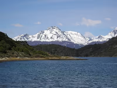
Due to its latitude, the island has a cold oceanic climate. The influences from the surrounding ocean and the predominant winds from the west result in the climate being uniform throughout the province. Mean annual temperatures are low, with winter temperatures averaging close to 0 °C (32 °F) and summer temperatures averaging around 10 °C (50 °F). Extreme temperatures range from 27 °C (81 °F) to −16 °C (3 °F) in the northeast and 29 °C (84 °F) to −21 °C (−6 °F) in the interior. The strong westerly winds from the Pacific Ocean decrease the perception of the temperature (wind chill). In the extreme south in the Beagle Channel which is surrounded by hills rising above 100 m (330 ft), winds can exceed 100 km/h (62 mph). The windiest months are from September to March. The island averages around 700 mm (28 in) of precipitation per year which is fairly evenly distributed throughout the year with a slight maximum in autumn. The lowest are in the extreme north where annual precipitation is around 280 mm (11 in) which increases to 550 mm (22 in) in the central parts of the Beagle Channel. Western parts of the province average around 2,000 mm (79 in) of precipitation a year. Snowfall is abundant throughout the island. Much of this island can be classified as within the Magellanic subpolar forests ecoregion.
Demographics
According to the 2022 Argentine national census, the Province of Tierra del Fuego has 190,641 inhabitants. Per Argentine census data, the province's population has grown substantially in recent decades, with an average annual growth rate of 3.3% between 2010 and 2022.
Government
The provincial government is divided into three branches.
Administrative divisions
Decree 149/70 of 8 April 1970 divided the province into four departments: Ushuaia, Río Grande, Islas del Atlántico Sur, and Antártida. Law 1186, enacted on 13 November 2017, split Tolhuin from Río Grande.
The province is divided into five departments (Spanish: departamentos):
Economy
Tierra del Fuego has since the 1970s benefited from government subsidies to local industry and from its natural wealth. Its estimated 2006 output of US$2.6 billion gave the province a per capita income of US$25,719, the second highest in Argentina, behind Buenos Aires.
Media
Newspapers
There are numerous main newspapers: El Diario del Fin del Mundo, El Sureño, Actualidad TDF, and El Diario La Prensa, as well as several other minor publications.