


Related on Lably
Through Tributary, Drainage basin and Head of state
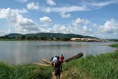
The Ubangi's length is about 1,060 km (660 mi). Its total length with the Uele, its longest tributary, is 2,270 km (1,410 mi). The Ubangi's drainage basin is about 651,915 km2 (251,706 mi2). Its discharge at Bangui ranges from about 800 m3/s (28,000 cu ft/s) to 11,000 m3/s (390,000 cu ft/s), with an average flow of about ~4,000 m3/s (140,000 cu ft/s). Its mean annual discharge at the mouth is around ~6,000 m3/s (210,000 cu ft/s). It is believed that the Ubangi's upper reaches originally flowed into the Chari River and Lake Chad before being captured by the Congo in the early Pleistocene.
Together with the Congo River, it provides an important transport artery for river boats between Bangui and Brazzaville. From its source to 100 km (62 mi) below Bangui, the Ubangi defines the boundary between the Central African Republic and the Democratic Republic of the Congo (DRC). Thereafter, it forms the boundary between the DRC and the Republic of Congo until it empties into the Congo River.
Lake Chad replenishment project
In the 1960s, a plan was proposed to divert waters from the Ubangi to the Chari River. According to the plan, named Transaqua, the water from the Ubangi would revitalize Lake Chad and provide a livelihood in fishing and enhanced agriculture to tens of millions of central Africans and Sahelians. Inter-basin water transfer schemes were proposed in the 1980s and 1990s by Nigerian engineer J. Umolu and the Italian firm Bonifica.
In 1994, the Lake Chad Basin Commission (LCBC) proposed a similar project, and at a March 2008 summit the heads of state of the LCBC member countries committed to the diversion project. In April 2008, the LCBC advertised a request for proposals for a feasibility study.