


Related on Lably
History
Kuang Si waterfall is located about 29 kilometers south of Luang Prabang city. The river that rises and flows into Tad Kuang Si waterfall is called Nam "Si" or Si River. The distance between its source and Tad Kuang Si waterfall is about 10 kilometers. The height of the waterfall is 60 meters. The water flows and falls in three cascade waterfalls over white limestone rocks into aquamarine turquoise (color) pools surrounded by tropical trees.
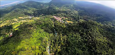
The source of Nam SI is located at the foot of the mountains where the Hmong people and Lao Theung, Khmu hill tribes once lived. Their villages were called Ban Nong Thouk, Ban Hin Oih and Ban Nam Ork (Exited). At the bottom of the waterfall is the village called Ban Tad. Due to slash-and-burn rice farming in the mountains and valleys by Hmong and Khmu farmers, the Nam Si River experienced drought. After 1975, the Lao government relocated the hill tribes to other places in the area to restore natural resources. Only a few straw houses still remain around this place for foreign tourists.
Sign in to keep reading
One more chapter is free with a Lably account.
Etymology
Nam Tok Tad means 'Waterfall; Nam means Water; Kuang means Deer; Si is the river name; Ban means village