


Related on Lably
Through Lake, Reservoir and Indian Ocean
The Zimbabwean town of Kariba was built for construction workers on the dam, while some other settlements such as Binga village and Mlibizi in Zimbabwe and Siavonga and Sinazongwe in Zambia have expanded to house people displaced by the resulting lake.
On 11 August 2026, the ferry Mbuya Nehanda running from Kariba to Chalala capsized, resulting in the death of at least 97 people, including 18 children. It is believed to be one of the deadliest boat disasters in Zimbabwe's history.
Physical characteristics
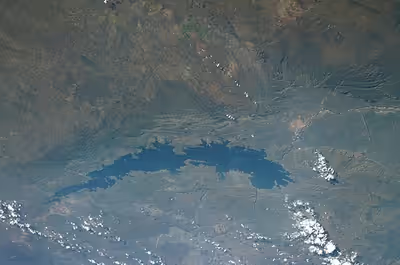
Lake Kariba is over 223 km (139 mi) long and up to 40 km (25 mi) in width. It covers an area of 5,580 km2 (2,150 sq mi) and its storage capacity is 185 km3 (44 cu mi). The mean depth of the lake is 29 m (95 ft); the maximum depth is 97 m (318 ft). It is the world's largest man-made reservoir by volume, four times as large as that created by the Three Gorges Dam. It was made on the orders of the government of the Federation of Rhodesia and Nyasaland. The enormous mass of water is believed to have caused induced seismicity in the seismically active region, including over 20 earthquakes of greater than 5 magnitude on the Richter scale.
The lake has several islands, including Maaze Island, Mashape Island, Chete Island, Sekula, Sampa Karuma, Fothergill, Spurwing, Snake Island, Antelope Island, Bed Island, and Chikanka.
Sign in to keep reading
2 more chapters are free with a Lably account.
Ecology
During the filling phase of the lake, the water was high in nutrients from decomposing inundated vegetation, creating a thick layer of fertile soil on land that became the lake bed. As a result, the ecology of Lake Kariba is vibrant. A number of fish species have been introduced to the lake, notably the sardine-like kapenta (transported from Lake Tanganyika), which now supports a thriving commercial fishery. Other inhabitants include the Nile crocodiles and hippopotamuses.
Gamefish, particularly tigerfish, which are indigenous to the Zambezi river system, now thrive on the kapenta, which in turn encourages tourism. Both Zambia and Zimbabwe are attempting to develop tourism along their respective shores.
Fish eagles, cormorants and other water birds patrol the shorelines, as do large numbers of elephants and other big game species including lion, cheetah, leopard, buffalo and a myriad of smaller plains game species. The southern Matusadona National Park was once a haven for black and white rhinoceros, but recent poaching activity has dramatically reduced their numbers.
Protected areas
The portion of Lake Kariba which falls within Zimbabwe has been designated a recreational park within the Zimbabwe Parks and Wildlife Estate.