

Lough Neagh
Freshwater lake in Northern Ireland
- 13 min read
- 5 chapters

Related on Lably
Through Fresh water, Eutrophication and Water treatment
Its main inflows are the Upper River Bann and Blackwater, and its main outflow is the Lower Bann. There are several small islands, including Ram's Island, Coney Island and Derrywarragh Island. The lake bed is owned by the 12th Earl of Shaftesbury and the lake is managed by Lough Neagh Partnership. Its name comes from Irish Loch nEachach , meaning "Eachaidh's lake".
From 2023 blue-green algae has polluted the lough.
Geography
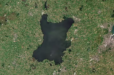
With an area of 148 square miles (383 km2), it is the British Isles' largest lake by area and is ranked 34th in the list of largest lakes of Europe. Located 20 miles (32 km) west of Belfast, it is about 19 miles (31 km) long and 9 miles (14 km) wide. It is very shallow around the margins and the average depth in the main body of the lake is about 30 feet (9 m), although at its deepest the lough is about 80 feet (24 m) deep.
Geology
Geologically the Lough Neagh Basin is a depression, built from many tectonic events dating back as far as 400 million years ago. These tectonic events are responsible for a NE-SW bedrock structure which has controlled many subsequent events. During the Paleozoic era, the Lough Neagh Basin was a depositional graben.
Hydrology
Of the 1,760-square-mile (4,550 km2) catchment area, around 9% lies in the Republic of Ireland and 91% in Northern Ireland; altogether 43% of the land area of Northern Ireland is drained into the lough, which itself flows out northwards to the sea via the River Bann. As one of its sources is the Upper Bann, the Lough can itself be considered as part of the Bann. Lough Neagh is fed by many tributaries including the rivers Main (34 mi, 55 km), Six Mile Water (21 mi, 34 km), Upper Bann (40 mi, 64 km), Blackwater (57 mi, 92 km), Ballinderry (29 mi, 47 km) and Moyola (31 mi, 50 km)
The water in the lough has been monitored extensively since 1974 and has undergone considerable eutrophication and toxic algal blooms. According to a 2016 study, it "has become much enriched as a result of anthropogenic eutrophication, most of which occurred in the last century... Despite the recent changes in nutrient loading the lake is still currently classed as hypereutrophic". Each summer since 2023, toxic algal blooms, mostly caused by agricultural run-off, have spread across the lake (see section algal bloom crises below).
Islands and peninsulas
- Coney Island
- Croaghan Island
- Derrywarragh Island
- Gartree Point
- Kinnegoe (peninsula)
- Kinturk (peninsula)
- Oxford Island (peninsula)
- Padian
- Ram's Island
- Tolans Flat
- Traad (peninsula)
Towns and villages
Towns and villages near the Lough include Craigavon, Antrim, Crumlin, Randalstown, Toomebridge, Ballyronan, Ballinderry, Moortown, Ardboe, Brockagh, Maghery, Lurgan and Magherafelt.
Counties
Five of the six counties of Northern Ireland have shores on the Lough (only Fermanagh does not), and its area is split among them. The counties are listed clockwise:
- Antrim (eastern side and northern shore of the lake)
- Down (small part in the south-east)
- Armagh (south)
- Tyrone (west)
- Londonderry (northern part of west shore)
Local government districts
The area of the lake is split between four local government districts of Northern Ireland, which are listed clockwise:
- 3 Antrim and Newtownabbey, in the north-east
- 4 Lisburn and Castlereagh, in the east
- 6 Armagh, Banbridge and Craigavon, in the south
- 9 Mid Ulster, in the west
Sign in to keep reading
4 more chapters are free with a Lably account.
Management
Lough Neagh is managed by Lough Neagh Partnership Ltd, a stakeholder group made up of elected representatives, land-owners, fishermen, sand traders and local community representatives. Lough Neagh Partnership is responsible for the lough's conservation, promotion and sustainable development together with navigation of the Lough.
Uses
Although the Lough is used for a variety of recreational and commercial activities, it is exposed and tends to get extremely rough very quickly in windy conditions.
Water supply
According to Northern Ireland Water, Lough Neagh supplies 40.7% of Northern Ireland's drinking water. There have long been plans to increase the amount of water drawn from the lough, through a new water treatment works at Hog Park Point, but these are yet to materialise. The lough's ownership by the 12th Earl of Shaftesbury has implications for planned changes to state-run domestic water services in Northern Ireland, as the lough is also used as a sewage outfall, and this arrangement is only permissible through Crown immunity.
Navigation
Traditional working boats on Lough Neagh include wide-beamed 4.9-to-6.4-metre (16 to 21 ft) clinker-built, sprit-rigged working boats and smaller flat-bottomed "cots" and "flats". Barges, here called "lighters", were used until the 1940s to transport coal over the lough and adjacent canals. Until the 17th century, log boats (coití) were the main means of transport. Few traditional boats are left now, but a community-based group on the southern shore of the lough is rebuilding a series of working boats.
In the 19th century, three canals were constructed, using the lough to link various ports and cities: the Lagan Navigation provided a link from the city of Belfast, the Newry Canal linked to the port of Newry, and the Ulster Canal led to the Lough Erne navigations, providing a navigable inland route via the River Shannon to Limerick, Dublin and Waterford. The Lower Bann was also navigable to Coleraine and the Antrim coast, and the short Coalisland Canal provided a route for coal transportation. Of these waterways, only the Lower Bann remains open today, although a restoration plan for the Ulster Canal is currently in progress.
Lough Neagh Rescue provides a search and rescue service 24 hours a day and has three stations, situated around the lough. These are at Antrim, Ardboe and Kinnego Marinas, Kinnego being its headquarters and founding station. It is a voluntary service funded by the district councils bordering the Lough. Its members are highly trained and are a declared facility for the Maritime and Coastguard Agency which co-ordinates rescues on Lough Neagh.
Bird watching
Lough Neagh attracts birdwatchers from many nations due to the number and variety of birds which winter and summer in the boglands and shores around the lough.
Flora
The flora of the north-east of Northern Ireland includes the algae:
- Chara aspera
- Chara globularis var. globularis
- Chara globularis var. virgate
- Chara vulgaris var. vulgaris
- Chara vulgaris var. papillata
- Tolypella nidifica var. glomerata
Records of Angiospermae include:
- Ranunculus flammula var. pseudoreptans
- Ranunculus auricomus, Ranunculus sceleratus
- Ranunculus circinatus, Ranunculus peltatus
- Thalictrum flavum, Thalictrum minus subsp. minus
- Nymphaea alba
- Ceratophyllum demersum
- Subularia aquatica
- Erophila verna sub. verna
- Cardamine pratensis
- Cardamine impatiens
- Cardamine flexuosa
- Rorippa palustris
- Rorippa amphibia
- Reseda luteola
- Viola odorata
- Viola reichenbachiana
- Viola tricolor ssp. curtissi
- Hypericum androsaemum
- Hypericum maculatum
- Elatine hydropiper
- Silene vulgaris
- Silene dioica
- Saponaria officinalis
- Cerastium arvense
- Cerastium semidecandrum
- Cerastium diffusum
- Sagina nodosa
- Spergularia rubra
- Spergularia rupicola
- Chenopodium bonus-henricus
- Chenopodium polyspermum
Fishing
Eel fishing has been a major industry in Lough Neagh for centuries. These European eels make their way from the Sargasso Sea in the Atlantic Ocean, some 4,000 miles (6,000 km) along the Gulf Stream to the mouth of the River Bann, and then make their way into the lough. They remain there for some 10 to 15 years, maturing, before returning to the Sargasso to spawn. Today Lough Neagh eel fisheries export their eels to restaurants all over the world, and the Lough Neagh Eel has been granted Protected Geographical Status under European Union law.
Nobel laureate Seamus Heaney produced a collection of poems A Lough Neagh Sequence celebrating the eel-fishermen's traditional techniques and the natural history of their catch.
Other fish species in the lake include dollaghan —a variety of brown trout native to the lake, salmon, trout, perch and pollan; bream, gudgeon, pike and rudd are also found, but are less common.
Human history
Name
The lough's English name derives from Irish Loch nEachach, meaning 'Eachaidh's lake'. At the start of the Plantation of Ulster, the English attempted to rename the lake 'Lough Sydney' and 'Lough Chichester', in honour of the Lord Deputies, but these did not supplant the older name.
Mythology and folklore
In the Irish mythical tale Cath Maige Tuired ("the Battle of Moytura"), Lough Neagh is called one of the twelve chief loughs of Ireland. The origin of the lake and its name is explained in an Irish tale that was written down in the Middle Ages, but is likely pre-Christian. According to the tale, the lake is named after Echaid (modern spelling: Eochaidh or Eachaidh), who was the son of Mairid (Mairidh), a king of Munster. Echaid falls in love with his stepmother, a young woman named Ébliu (Ébhlinne). They try to elope, accompanied by many of their retainers, but someone kills their horses.
In some versions, the horses are killed by Midir (Midhir), which may be another name for Ébliu's husband Mairid. Óengus (Aonghus) then appears and gives them an enormous horse that can carry all their belongings. Óengus warns that they must not let the horse rest or it will be their doom.
After reaching Ulster the horse stops and urinates, and a spring rises from the spot. Echaid builds a house there and covers the spring with a capstone to stop its overflowing. One night, the capstone is not replaced and the spring overflows, drowning Echaid and most of his family, and creating Loch n-Echach (Loch nEachach, the lake of Eachaidh).
The character Echaid refers to the Dagda, a god of the ancient Irish who was also known as Echaid Ollathair (meaning "horseman, father of all"). Ébliu, Midir and Óengus were also names of deities. Dáithí Ó hÓgáin writes that the idea of a supernatural being creating the landscape with its own body is an ancient one common to many pre-Christian cultures. A Gaelic sept called the Uí Echach ("descendants of Echaid") dwelt in the area and it is likely their name comes from the cult of the god. They gave their name to the territory of Iveagh.
Another tale tells how the lake was formed when Ireland's legendary giant Fionn mac Cumhaill (Finn McCool) scooped up a chunk of earth and tossed it at a Scottish rival. It fell into the Irish Sea, forming the Isle of Man, while the crater left behind filled with water to form Lough Neagh.
History
In 839, a group of Vikings based a fleet on Lough Neagh, where they wintered during the winter of 840. Prior to the Tudor conquest of Ireland, the lough had been largely unclaimed by local Gaelic nobles, such as the O'Neill and O'Donnell dynasties. During the reign of Elizabeth I, an Englishman, Sir Hugh Clotworthy, settled near Antrim as part of the Plantation of Ulster and was granted the office of "Captain of Lough Neagh" by the Dublin Castle administration, being paid a stipend in return for maintaining boats on the lough to enforce the Crown's authority. Clotworthy was succeeded in the office by the 1st Viscount Massereene and the 2nd Viscount Massereene. In 1660, Charles II of England gave the 1st Viscount Massereene the rights to the fish and bed of the lough.
During the early seventeenth century, Sir Arthur Chichester, later created the 1st Baron Chichester, gradually laid claim to Lough Neagh during the Stuart conquest of Ulster, taking advantage of the Flight of the Earls. He first laid claim to the lough's infrastructure, then to its boats, then the shores and finally the lough in its entirety, including all relevant fishing rights. It is possible he did this without approval from James VI and I. The lough was later inherited by Edward, 1st Viscount Chichester, Sir Arthur's younger brother; Edward's descendants later married into the Shaftesbury family. In 2012, it was reported that the 12th Earl of Shaftesbury was considering transferring ownership of the lough to the Northern Ireland Assembly.
In October 2023, Lord Shaftesbury stated in an interview with BBC Northern Ireland that while he was open to selling Lough Neagh to the Northern Irish public, he would not give it away for free. He stated in the interview that "the sale is one that's borne out of an understanding that my ownership has always been very divisive and quite political and I always get blamed for things that are completely outside of my control. I feel it's often used as an excuse for political inaction and I always want to do the right thing by the people living here and what's in the best interest of the lough."
In February 2024 concerns were raised at the sudden collapse in insect numbers on the Lough and the likely effects this will have on biodiversity in the area.
Algal bloom crises
Lough Neagh underwent catastrophic cyanobacteria or blue green algae bloom events in the summer of 2023 and 2024 which reached international news channels. This has led to numerous local community and environmental organisation responses, such as a mock wake for the lake being held in protest and calls for drastic action to solve the problem. The size of these algal blooms in Lough Neagh has allowed them to be visible from space. These algal blooms have the potential to have significant impacts on the lakes ecology due to the toxins they produce posing a serious risk to wildlife, including birds and fish, risking declines in populations and disrupting the food web. In addition, the growth of the algal blooms depletes oxygen in the water which can cause fish kills. There are also threats to human health from toxins and pathogens detected in the algal mats found in the lake.
These harmful algal blooms have a number factors contributing to their occurrence in Lough Neagh. The foremost contributory factor is the eutrophication of the lake with nutrients like phosphorus and nitrates which have provided suitable conditions for the algae to thrive. The lake has been classified as one of the world's most hyper-eutrophic water-bodies due to chronic eutrophication occurring over many years. Key drivers of this eutrophication are increases in nitrates and phosphates in the lake which are generally attributed to runoff from agriculture in the form of animal slurry residue of chemical fertilizer in addition to human sewage. Research has indicated that 62% of the phosphorus inputs are from agricultural origins, 24% are from wastewater treatment works and 12% are from septic tanks.
A number of other environmental factors have contributed to the occurrence of the harmful algal blooms. Climate change has contributed to increasing summer temperatures of, and sunlight intensity on, the lake, creating more suitable conditions for rapid growth of harmful algal blooms. As the lake is relatively shallow with an average depth of 9m, its temperature can increase more rapidly than other deeper lakes, making it more susceptible to algal blooms.
The invasive zebra mussel mollusc species which has invaded the lake has resulted in the lake water having greater clarity and so penetration of light. The increase in light intensity deeper in the water column has increased the chance of harmful algal blooms occurring. The zebra mussel which is a filter feeder on phytoplankton in the lake, will selectively feed on existing phytoplankton species but not on the blue green algae, creating a lower ecological competition scenario for these algae.
When the algal bloom crisis of 2023 occurred, the Northern Ireland Assembly was suspended and Northern Ireland had no functioning devolved government. The Social Democratic and Labour Party MLA Matthew O'Toole referred to the state of the lough as "a metaphor for the poisoned state of politics and governance in the North". After the Assembly and Executive were restored in February 2024, all major parties agreed that action was required to address the crisis, and by July 2024 an action plan proposed by the Minister of Agriculture, Environment and Rural Affairs, the Alliance Party's Andrew Muir had been agreed, although some aspects of the plan had to be scaled back due to resistance from the Democratic Unionist Party (DUP), whose support was required for aspects of the action plan that cut across government departments, due to the rules of power-sharing within the Northern Ireland Executive. Despite supporting the action plan, Sinn Féin MLAs voted alongside DUP members in June 2025 to oppose the proposed contents of a new Nutrients Action Programme that Muir's department was consulting on and which was promised by the Lough Neagh action plan.
Some environmental activists have argued that the lough needs to be brought into community ownership and granted rights, inspired by the global rights of nature movement.