

La Pérouse Strait
Strait between Hokkaido, Japan and Sakhalin, Russia
- 2 min read
- 2 chapters

Related on Lably
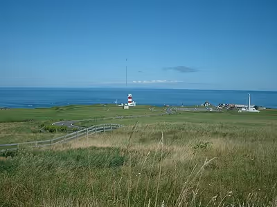
The strait is 42 km (26 mi) wide and 40 to 140 m (131 to 459 ft) deep. The narrowest part of the strait is in the west between Cape Krillion in Sakhalin and Cape Sōya in Hokkaidō, which is also the shallowest at only 60 metres (197 ft) deep. A small rocky island, appropriately named Kamen Opasnosti (Russian for "Rock of Danger") is located in the Russian waters in the northeastern part of the strait, 8 miles (13 km) southeast of Cape Krillion. Another small island, Bentenjima, lies near the Japanese shore of the strait.
The strait is named after Jean-François de Galaup, comte de Lapérouse, a French naval officer who explored it in 1787 as part of a round-the-world voyage.
Japan's territorial waters extend to three nautical miles into La Pérouse Strait instead of the usual twelve, reportedly to allow nuclear-armed United States Navy warships and submarines to transit the strait without violating Japan's prohibition against nuclear weapons in its territory.
History
Between 1848 and 1892, American whaleships passed through the strait in the spring and summer as they made their way from the right whale grounds in the Sea of Japan to the Sea of Okhotsk to hunt right and bowhead whales. The ship David Paddack (352 tons), Captain Swain, of Nantucket, was bound home with a full cargo when it wrecked in the strait in 1848.
The submarine USS Wahoo, skippered by Dudley W. "Mush" Morton, was sunk in the strait on her seventh war patrol in October 1943. The submarine's hull was found and identified as Wahoo on Oct. 31, 2006.
Sign in to keep reading
One more chapter is free with a Lably account.
Proposed rail crossing
The Sakhalin–Hokkaido Tunnel has been proposed to connect Japan and Russia under the Strait, further connecting to the Trans-Siberian Railroad. A bridge has also been proposed.