

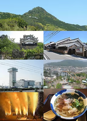

Explore on Lably
ToursExplore Lably’s 3D toursGeography
Toyohashi is located in southeastern Aichi Prefecture, and is the capital of the informal "Higashi-Mikawa Region" of the prefecture. It is bordered by Shizuoka Prefecture to the east, and by Mikawa Bay and the headlands of the Atsumi Peninsula to the west. To the south is the Enshū Sea of the Pacific Ocean. The presence of the warm Kuroshio Current offshore gives the city a temperate climate. The Katahama Jusan-ri Beach (片浜十三里) stretching in adjacent city of Tahara to the west, Toyohashi, and the city of Hamamatsu to the east is a sea turtle nesting spot.
Climate
The city has a climate characterized by hot and humid summers, and relatively mild winters (Köppen climate classification Cfa). The average annual temperature in Toyohashi is 16.3 °C (61.3 °F). The average annual rainfall is 1,651.3 mm (65.01 in) with September as the wettest month. The temperatures are highest on average in August, at around 27.5 °C (81.5 °F), and lowest in January, at around 5.4 °C (41.7 °F).
Demographics
Per Japanese census data, the population of Toyohashi has grown steadily over the past 60 years.
Neighboring municipalities
- Shinshiro
- Tahara
- Toyokawa
- Hamana-ku, Hamamatsu
- Kosai
City scape
Sign in to keep reading
11 more chapters are free with a Lably account.
History
Origins
The area around present-day Toyohashi has been inhabited for many thousands of years. Archaeologists have found human remains from the Japanese Paleolithic period, which have been carbon dated to more than 10,000 BC along with the bones of Naumann elephants.
Numerous remains from the Jōmon period, and especially from the Yayoi and Kofun periods have also been found, including many kofun burial mounds.
During the Nara period, the area was assigned to Atsumi, Hoi and Yana Districts of Mikawa Province and prospered during subsequent periods as a post town on an important river crossing of the Tōkaidō connecting the capital with the eastern provinces.
Sengoku period
During the Sengoku period, the area was a highly contested zone between the Imagawa clan based in Suruga Province and various local warlords, who built a number of fortifications in the area, including Yoshida Castle. The rising power of the Matsudaira clan and its alliance with Oda Nobunaga eventually neutralized the threat posed by the Imagawa, and the area became part of the holdings of Tokugawa Ieyasu. Following the Battle of Odawara in 1590, Toyotomi Hideyoshi ordered the Tokugawa clan to relocate to the Kantō region and assigned the castle to Ikeda Terumasa. Ikeda developed the surrounding castle town and embarked on a massive and ambitious plan to rebuild Yoshida Castle. However, following the Battle of Sekigahara, he was relocated to Himeji Castle.
Edo period
After the establishment of the Tokugawa shogunate, Yoshida Castle became the center of Yoshida Domain, a clan fief. The domain was assigned to several different fudai daimyō clans until coming into the possession of the Matsudaira (Nagasawa-Ōkōchi) clan in 1752, which remained in residence at Yoshida until the Meiji Restoration. The final daimyō of Yoshida, Matsudaira Nobuhisa, surrendered the domain to the Meiji government in 1868. In 1869, the name of the domain was formally changed from Yoshida to Toyohashi.
Meiji period
With the establishment of the modern municipalities system under the Meiji government in 1879, Toyohashi Town was created within Atsumi District, Aichi Prefecture. Toyohashi Zoo was established in 1899. The town achieved city status in 1906.
Taishō period
A tram system (the present-day Toyohashi Railway Asumadai Main Line) was established in 1925.
Shōwa period
In 1932, Toyohashi expanded its borders by annexing Shimoji Town (Hoi District), Takashi Village, Muroyoshida Village (Atsumi District), and Shimokawa Village (Yana District). Toyohashi suffered considerable damage during the 1944 Tōnankai earthquake, and even more damage during the Toyohashi Air Raid, which destroyed more than 60% of the city in June 1945.
Modern Toyohashi
In 1955, Toyohashi's geographic extent was expanded again with the annexation of neighboring Maeshiba Village (Hoi District), Futagawa Village, Takatoyo Village, Oitsu Village (Atsumi District) and Ishimaki Village (Yana District). Toyohashi achieved core city status in 1999 with increased autonomy from the prefectural government.
Government
Mayor-council
Toyohashi has a mayor-council form of government with a directly elected mayor and a unicameral city legislature of 36 members.
Prefectural Assembly
The city contributes five members to the Aichi Prefectural Assembly.
House of Representatives
In terms of national politics, the city is part of Aichi District15 of the lower house of the Diet of Japan.
List of mayors of Toyohashi (from 1907)
Public
Police
- Aichi Prefectural Police
- Toyohashi police station
Firefighting
- Toyohashi Fire department
- Toyohashi-Minami fire department
- Toyohashi-Naka fire department
Health care
- Hospital
- Toyohashi City Hospital
Post office
- Toyohashi Post office
- Toyohashi-Minami Post office
Library
- Toyohashi City Library
- Toyohashi City Central Library
- Toyohashi City Mukaiyama Liburary
- Toyohashi City Oshimizu Liburary (Minakuru)
International relations
- Sister cities
- Nantong, Jiangsu, China, since May 1987
- Toledo, Ohio, United States, since April 2000
- Panevėžys, Lithuania, since June 2019
- Friendship cities
- Jinju, South Gyeongsang, South Korea, since 1992
- Paranavaí, Paraná, Brazil, since 2008
- Wolfsburg, Lower Saxony, Germany, since 2011
Economy
Agriculture
- Japan Agricultural Cooperatives
- JA Toyohashi
Manufacturing
Industrial production is centered around the production of automotive-related components for Toyota, Mitsubishi, Suzuki Motors, and Honda, all of whom have factories in the region.
- Motors
- Toyota
- Mitsubishi
- Suzuki Motors
- Honda
- VOLKSWAGEN Group Japan
Trade and services
- Worldwide trade
Mikawa Port is a major port for worldwide trade, and its presence has made Toyohashi the largest import and export hub in Japan for automobiles, in volume terms. Compared to other ports around the world, Mikawa is roughly on a par with the German port of Bremerhaven.
- Shopping center
- APiTA Mukaiyama
- Æon Toyohashi-Minami Shopping center
- Æon Town Toyohasihashira
- Cocola Avenue
Media
Studio
- FM Toyohashi (JOZZ6AA-FM, 84.30 MHz)
Newspaper
- Higashi Aichi Newspaper
- Tonichi Shimbun Newspaper
Education
Universities
- National university
- Toyohashi University of Technology
- Private university
- Aichi University
- Toyohashi Sozo College
- Private college
- Aichi Junior College
Primary and secondary schools
- Toyohashi has 52 public elementary schools and 22 public middle schools operated by the city government, and eight public high schools operated by the Aichi Prefectural Board of Education. The city also has one private middle school and three private high schools. The prefecture also operated three special education schools for the handicapped.
International schools
- Escola Alegria de Saber (エスコーラ・アレグリア・デ・サベール) - Brazilian school
- Escola Cantinho Brasileiro (カンティーニョ学園) - Brazilian primary school
- EJA Interativo – Educação de Jovens e Adultos - Brazilian institution
- Toyohashi Korean Elementary School and Kindergarten (豊橋朝鮮初級学校) - North Korean school
Transportation
Railway
Toyohashi Station is on the Tōkaidō Shinkansen and the Tōkaidō Main Line. Hikari shinkansen services stop at Toyohashi Station approximately once every two hours, and Kodama services stop twice an hour. Toyohashi Station is also the terminus of the Iida Line, Meitetsu Nagoya Main Line, Toyohashi Railroad Atsumi Line, and the Toyohashi Railroad Azumada Main Line, making it an important transportation hub.
Highspeed rail
- Central Japan Railway Company
- Tōkaidō Shinkansen: Toyohashi
Conventional lines
- Central Japan Railway Company
- Tōkaidō Main Line: Toyohashi • Futagawa
- Iida Line: Toyohashi • Funamachi • Shimoji
- Meitetsu
- Meitetsu Nagoya Line: Toyohashi
- Toyotetsu
- Toyohashi Railroad Atsumi Line: Shin-Toyohashi • Yagyu-bashi • Koike • Aichidaigakumae • Minami-Sakae • Takashi • Ashihara • Ueta • Mukougaoka • Ōshimizu • Oitsu • Sugiyama
Tramway
- Toyotetsu
- Toyohashi Railroad Azumada Main Line: Ekimae • Ekimae-ōdōri • Shinkawa • Fudagi • Shiyakushomae • Toyohashi-kōenmae • Higashi-hatchō • Maehata • Azumada-sakaue • Azumada • Keirinjōmae • Ihara • Akaiwaguchi
- Ihara • Undōkōen-mae
Bus
Almost all services are operated by Toyotetsu Bus, a subsidiary of Toyohashi Railroad.
Air
The nearest airport is Chubu Centrair International Airport, located 92 km (57 mi) north west of Toyohashi.
Roads
Highway
- Tomei Expressway
Japan National Route
- National Route 1
- National Route 23
- National Route 42
- National Route 151
- National Route 259
- National Route 362
Sea port
- Port of Toyohashi (Port of Mikawa)
Local attractions
Places of interest
- Toyohashi Park, which includes the site of Yoshida Castle (吉田城址), and the Toyohashi City Museum Art and History.
- Site of Nirengi Castle
- Toyohashi City Public Hall (豊橋市公会堂, Toyohashi-shi Kōkaidō), a National Important Cultural Property .
- Toyohashi Orthodox Cathedral (豊橋ハリストス正教会), a National Important Cultural Property
- Futagawa-juku honjin museum
- Toyohashi Zoo
- Toyohashi Natural History Museum
- Toyohashi Museum of Natural Resources
Facilities and parks
Toyohashi has many parks, including the Natural History Museum and Zoological Park, the Imou swamp, Mikawa Seaside Forest, Kamo Iris Garden, and the Mukaiyama Ume Garden. It also has what is considered one of the best surfing beaches in Aichi and the surrounding region.
Culture
Festivals
Toyohashi Festival, Spring Festival, Iris Flower Festival, Gion Festival, Demon Festival (February), and traditional marionette performances (Akumi joruri). At some of these festivals, especially the summer festivals, the use of traditionally handcrafted fireworks is showcased, and include hand-held bamboo-tube fireworks known as tezutsu hanabi.
Special products
Chikuwa (a type of baked sausage roll made from fish), Gohei rice cake (五平餅, Gohei-mochi), beach fermented soybeans, food boiled in goby fish and soy, top producer of quail eggs in Japan, Toyohashi calligraphy brush (豊橋筆, Toyohashi-fude).
In popular culture
In the fictional Harry Potter universe, Toyohashi is the hometown of the professional Quidditch team, the Toyohashi Tengu.
In the Takeshi Kitano movie Kikujiro, the story revolves around the characters' trip from Tokyo to Toyohashi.
Toyohashi is the setting of the light novel series Makeine: Too Many Losing Heroines!, the anime television adaptation of which premiered in July 2024.
Sports
Basketball
- San-en NeoPhoenix (Toyohashi City General Gymnasium)
Baseball
- Chunichi Dragons (Toyohashi Municipal Baseball Stadium)
Notable people from Toyohashi
- Yua Aida, AV idol and model
- Katsuhito Asano, Japanese politician
- Daniel (Nushiro) of Japan, primate of Japanese Orthodox Church
- Atsushi Fujii, professional baseball player
- Emi Fujino, mixed martial artist, kickboxer and professional wrestler
- Mizuki Inoue, kickboxer and mixed martial artist
- Yoshitaka Iwamizu, Olympic long-distance runner
- Kitaro, musician
- Aya Kitō, writer
- Masaji Kiyokawa, Olympic gold-medalist swimmer
- Masatoshi Koshiba, Nobel Prize winner
- Sayaka Kurara, is a Japanese professional wrestler
- Ken Matsudaira, actor
- Rena Matsui, actress, former member of SKE48
- Yūji Mitsuya, actor, voice actor
- Nashiko Momotsuki, cosplayer, actress, Toyohashi tourism ambassador
- Masahiko Morifuku, professional baseball player
- Sakura Nogawa, voice actress
- Kenichi Ogawa, boxer
- Yoshio Sawai, manga artist
- Akiko Suzuki, professional figure skater
- Buyūzan Takeyoshi, sumo wrestler
- Sakon Yamamoto, professional race car driver
- Takibi Amamori, novelist